 Fair Housing Notice
 When driving around Buffalo, Kenmore and Niagara Falls, it’s likely you’ve cruised down Military Road. But most residents, including locals, aren’t aware of the historical significance of this ordinary-looking road or how it got its name.
Since our apartment communities are located throughout the Buffalo-Niagara region, we think it’s important to recognize the historical context of our area, as it helps us understand how we got to where we are today.
According to the Buffalo History Gazette, Military Road was named such because it was built by soldiers after the American Revolution, as part of the national defense. But there’s a lot more to the story.
Why Military Road Was Constructed
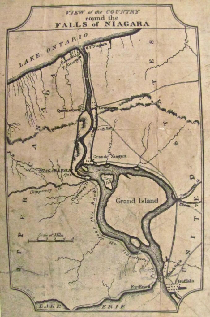
In the early 1800s, Americans occupied Fort Niagara, which signaled the beginning of settlement along the New York side of the river. The fort served as both an important guard post for the American side of the Niagara Portage as well as protection from outside forces, according to Old Fort Niagara.
As hostilities between the United States and Britain grew, Fort Niagara became an extremely important part of the American defense, and Military Road was intended to allow for military travel between the recently settled villages.
The federal government wanted the road to serve as a military highway extending through from the top of the Lewiston escarpment to the bluff at Black Rock in New Amsterdam — what is now Buffalo. A large fort was planned at Black Rock to guard the entrance to the Niagara River, according to the Gazette.
Because the road path cut through forests and over swamplands, and the soldiers lacked modern equipment, the construction of the road was a long and difficult undertaking. After years of construction, turmoil and disagreements between New York state and the federal government, the road was finally completed in 1809.
How Military Road Was Used
The new road cut through various settlements including Tonawanda, Niagara Falls and Youngstown. But the proposed fort at Black Rock did not end up being constructed, and thus the road was largely not needed for military activities.
Military Road did get some use, however, during the War of 1812, when American General George McClure used it to travel to Buffalo in the winter of 1813. General McClure had abandoned Fort Niagara, leaving soldiers to defend themselves against the British invasion he had caused by burning Newark, now known as Niagara on The Lake. The British subsequently captured Fort Niagara and burned several towns in New York, according to History of Buffalo.
After not being used for its intended purpose for several years, by 1820 Military Road had become overgrown with weeds and bushes, and only sections of it were used by local farmers, according to the Gazette.
Economic Impact of Military Road
Luckily, Military Road later saw a renaissance after years of neglect. In 1832 the surface of the road was cleared and repaired, and it became a state highway available for general use, according to the Gazette.
Once Military Road was able to be used year-round for transportation, it allowed for more commercial development between Erie and Niagara counties, according to Old Fort Niagara.
According to Wikipedia, during the 1890s trolley service through the village of Kenmore was extended along Military Road, and commuters who lived in Kenmore could now easily access the Belt Line, which would take them to the city of Buffalo for work. A trolley station was built along Military Road to make this possible.
Military Road Today
When you drive along Military Road anywhere in the Buffalo-Niagara region, you’re driving along the original path that was constructed in the early 1800s. The road is now part of the larger NY Route 265, which extends south of Tonawanda and north into Lewiston.
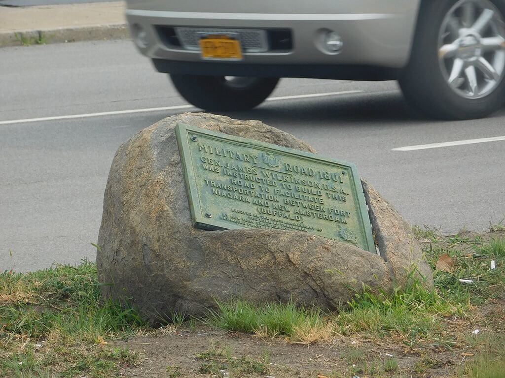
If you’re interested in the historical aspects of the road, you should check out the plaque honoring the construction of Military Road at the intersection of NY 265 and NY 324 (Sheridan Drive) in Kenmore, seen in the photo below.
Today, Military Road serves as an important regional landmark and roadway, preserving the area’s heritage while continuing to facilitate travel and development between Erie and Niagara counties.